By Billy Burle, VP Sales and Marketing
We’re excited to announce DREAMaps Online now includes a comp tool. The new comp tool allows you to select a subject parcel and identify the most relevant comps. Sounds simple, right? Well, simple is often difficult to create. We spent a lot of time during the design process talking with many appraisers, GIS professionals, and realtors to identify what would provide you with the most value. We also reviewed other comp tools on the market to identify what was missing from current offerings.
Based on the feedback, we focused on two things: usability and flexibility.
- Usability – This is a core focus in everything we do. Our goal is to make it so easy to use that a child could figure it out just by clicking around. Of course, that may not be as impressive as it used to be since kids these days seem to be training us on how to use various devices 🙂
- Flexibility – One of the biggest complaints we received about other comp tools was that they were not flexible enough. Therefore, we made ours as flexible as possible by providing an easy to use admin section that allows users to configure most of the data in the comp tool. Users can decide what filters to include in the drop down menu based on any attribute in the database and even set default filters to automatically run. Users can also decide what data to display in each of the pop-up windows as well as what to display on the printable comp report.
Here’s what the tool looks like:


As you can see, the DREAMaps Online comp tool makes it easier than ever to “show your work”. If you would like to learn more or see a live web demo contact sales@sds-inc.com


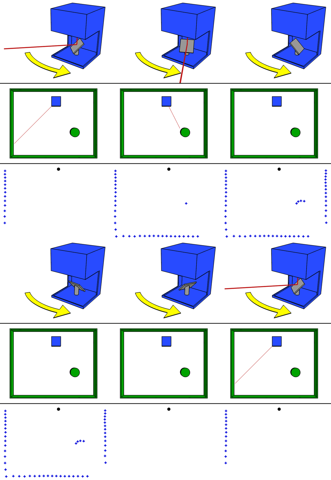 Laser Imaging Detection and Ranging. Even the name makes it sound futuristic. However, LiDAR is merely a remote sensing technology that uses laser light sensors mounted on either vehicles or aircraft to illuminate a target in order to gather the appropriate data. Notice the animation to the right showing a simplistic view of a laser identifying surface area (from wikipedia). The result of a LiDAR collection is what is called a point cloud or a 3D image made up of points representing the external surfaces of the target objects. A single sensor may collect up to 800,000 X, Y, and Z points per second to create a 3D model and animations.


